Posts

Showing posts from April, 2012

Cheddar Gorge & Cheddar Caves, England

Image
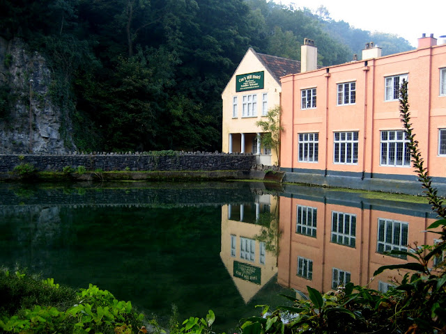
         Cheddar Gorge & Cheddar Caves Somerset England, a steep narrow limestone gorge surrounded by cliffs near the town of Cheddar, runs through the Mendip Hills. It is the largest gorge in Great Britain, dropping to a maximum depth of 113meters. Cheddar Caves where a constant 7degree C is maintained throughout the year, and that was how cheddar cheese was born here. In addition, Britain's oldest complete human skeleton was found in the Cheddar caves-- the 9000-year-old Cheddar Man. There are around 300,000 visitors annually.         Cheddar 峽谷坐落在英國西南邊,這是一個石灰岩峽谷,峭壁最高有113米高.Cheddar 山洞終年維持7度C,因此成為出名的Cheddar乾酪的發源地.壯麗峽谷景色和Cheddar乾酪的傳奇故事使這裡成為英國出名風景點,每年吸引約三十萬遊. Cheddar Gorge Cheddar cheese store in the cave

Kura Track~Puriri Ridge Track~Omanawanui Track

Image
Route: Kura Track→ Puriri Track → Mt Donald Mclean → Puriri Ridge Track → Omanawanui Track →           Whatipu Beach Grade: Easy         The hilltop track provides us a fantastic panoramic view of Manukau Harbour. It is one of the annual pilgrimages of our Friday tramping group. We love the blending of the green hill and azure sea.         這是一條很美的步道,走過棕梠樹密布的悠悠溪谷和巨龍般的山脊.沿途可以欣賞到Manukau Harbour 蔚藍的海景,享受登高望遠的開闊快感.星期五登山隊的老夥伴七十幾歲老人了,仍然每年都要走一次,可以知道這一條步道有多吸引人. Whatipu carpark View from Mt Donald Mclean Mt Donald Mclean

Queenstown, Tasmania Australia

Image
        Queenstown Tasmania Australia is an old copper and gold mining town set in a surreal, lunar landscape. The startling moonscape was caused by a combination of tree removal to fire the belching semetters, pollution of poisonous sulfurous fumes, annual heavy rainfall washing away the topsoil and exposing the purple and gold rocks beneath. It is a stark wonder of the world.         澳洲Tasmania的皇后鎮是一座銅礦金礦的採礦城鎮,因長期採礦的破壞形成特殊荒涼的景色,所以被收入1001自然奇觀.其實"人為破壞奇觀"恐怕更名符其實.當我們開車接近Queenstown時,看到的不只是荒涼景色,壯麗的礦山更令人嘆為觀止. 銅礦的礦坑view from Iron Blow Open Cut Lookout Queenstown 的老街

Karekare Beach to Mercer Bay

Image
        On dry weather and wind less than 10k with low tide less than 0.9 meter, there is a very beautiful but challenging tramping route in Waitakere Regional Park, from Karekare Beach via Farley Point to Mercer Bay to visit sea caves and then uphill to Ahu Ahu Track back to Karekare Beach. It takes 4 hours to complete the loop and needs to start 2 hours before low tide. Be careful to rock-hopping on the way. Mercer Bay 是我們非常喜歡的地方,以前我們從cliff 上直接下到Mercer Bay,昨天天氣很好所以 Eric 邀了幾位健腳在最低潮之前二小時開始從Karekare Beach 海邊直接越過headland 到Mercer Bay 探山洞.因最低潮仍有超過一米, 所以海水有點高,走來既刺激又興奮.浪花衝擊峭壁石頭壯觀的景色,令人讚嘆! Notice:On dry weather and wind less than 10k with low tide less than 0.9 meter. 必須風平浪靜的好天,加上當天最低潮時低於0.9米. Grade: M 4hours

Mount Stokes Track -- Eric & Jane's Favorite Day Walks in New Zealand

Image
        Mt Stokes the highest point in the Marlborough Sounds. The 1203 metre summit offers one of the finest views in the country, a 360-degree panorama of the Marlborough Sounds including both Pelorus and Queen Charlotte sounds.         此次南島行第二天我們登上1203m高的Stokes 山,這是Marlborough 峽灣最高峰.在山頂可以看到360度的峽灣景色.今天颳大風且下雨,我們幸運的看到了霧濛濛的峽灣.長滿青苔的silver beech 在雲霧中恍如仙境,步行其間令人飄飄然. 風太大了,把海水吹得凌空而起.